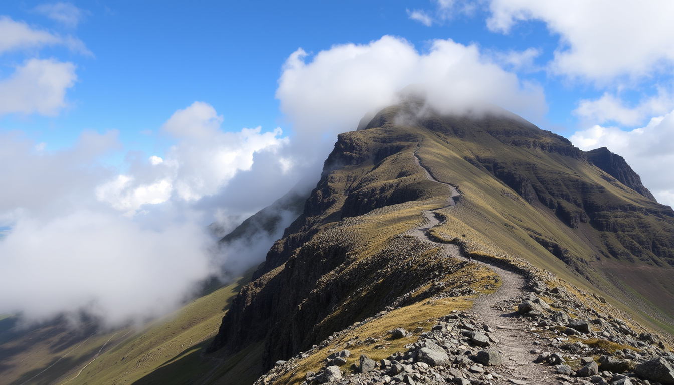
There’s a reason Ben Nevis sees over 150,000 climbers every year: it’s the tallest peak in the British Isles and a rite of passage for hikers. But the Mountain Track isn’t a gentle stroll—it’s a 10.2-mile round trip with nearly 1,345 metres of ascent that demands respect for the weather and your own limits. This guide lays out the real-world numbers, the risks, and the practical steps to prepare, so you can decide whether your first Ben Nevis climb is a smart goal or a lesson in overreach.
Height: 1,345 meters (4,413 feet) ·
Location: Grampian Mountains, Scotland ·
Annual climbers: Over 150,000 ·
Mountain track distance: 10.2 miles (16.4 km) round trip ·
Average climb time: 7–9 hours ·
Tallest in: United Kingdom and British Isles
Quick snapshot
- Ben Nevis is 1,345 m tall (Mountaineering Scotland)
- Over 150,000 people attempt the climb each year (RAW Adventures)
- Exact annual fatality figures vary by year (Ben Nevis guide safety page)
- Weather conditions can change unpredictably (RAW Adventures) (Ben Nevis guide safety page)
- Check current conditions via the ranger base (Mountaineering Scotland) (Wilderness Scotland)
- Plan a summer ascent (May–September) for best odds of good weather (Wilderness Scotland)
Six key numbers, one pattern: Ben Nevis is a serious mountain that rewards preparation over luck.
| Fact | Value |
|---|---|
| Height | 1,345 m (4,413 ft) |
| Prominence | 1,345 m (highest in UK) |
| Mountain range | Grampian Mountains |
| First ascent | 1771 by James Robertson |
| Annual visitors | Over 150,000 |
| OS grid reference | NN166712 |
How long does it take to climb up Ben Nevis?
Mountain Track typical duration
Most climbers take between 7 and 9 hours for the round trip on the Mountain Track, according to RAW Adventures (specialist mountain guiding company). The route covers about 16 km with 1,340 metres of ascent. Some sources estimate 6 to 8 hours, but the extra hour accounts for real-world breaks and weather delays.
Factors that affect climb time
- Fitness level: A good baseline of hillwalking fitness cuts up to 2 hours off the total.
- Weather: Rain, wind, or fog can slow your pace significantly.
- Start time: Late starts force faster descents to avoid darkness.
- Group size: Larger groups move at the pace of the slowest member.
The pattern: Preparation directly controls your time on the hill.
Is Ben Nevis a difficult climb?
Technical difficulty rating
On AllTrails, the Mountain Track is graded as “challenging.” The path itself requires no technical climbing—no ropes, no rock climbing moves—but it’s a strenuous mountain walk. Mountaineering Scotland (the national governing body for hillwalking) warns that the route is “not an easy hike” and demands proper footwear, navigation skills, and fitness.
Common challenges for hikers
- Navigation: The path is clear in good weather but becomes faint near the summit, especially in fog. The Ben Nevis guide safety page notes that “navigation is notoriously difficult” even for experienced walkers.
- Exposure: The summit approach passes close to cliffs and the North Face drop, creating serious exposure.
- Fatigue: The long descent stresses knees and legs, especially if you’re not used to consecutive hours of downhill.
The same route that seems easy in clear summer conditions can turn into a survival challenge when the weather closes in. The Ben Nevis guide safety page reports that the path “peters out” near the top, leaving walkers to navigate on bearing alone.
The implication: Difficulty is weather-dependent, not just technical grade.
Can a beginner climb Ben Nevis?
Preparation tips for first-timers
Yes, beginners can climb Ben Nevis, but only with proper preparation. RAW Adventures (specialist mountain guiding company) states that “beginners can climb with proper preparation.” Key steps include:
- Train beforehand: Build up to long hillwalks with 800–1,000 m of ascent.
- Carry the right gear: Waterproof jacket and trousers, warm layers, hat, gloves, map, compass, headtorch, food, and water.
- Mountaineering Scotland explicitly warns against flip-flops, wellies, normal shoes, and gym trainers.
- Start early: Aim to be off the summit by early afternoon to avoid descending in the dark.
Guided vs unguided climbs
For first-timers, a guided tour is strongly recommended. Local companies like Elite Guides offer day trips that include navigation instruction and safety briefing. The cost adds about £50–£80 per person, but it’s a small price for the expertise of someone who knows the route and the mountain’s mood swings.
A guided climb reduces the risk of a navigational error that could lead to a 999 call. Mountaineering Scotland advises that if you get lost or injured, dial 999 or 112 and ask for Police, then Mountain Rescue.
The takeaway: Beginners can succeed with training and the right support.
What makes Ben Nevis dangerous?
Weather hazards
Ben Nevis weather is notoriously fickle. RAW Adventures warns that “good weather at the base does not guarantee safe conditions on the summit.” The summit temperature can be 10–15°C lower than at the car park, and wind speeds can double. Rain, fog, and snow are possible even in summer.
Navigation risks
As mentioned, path visibility is the main culprit. The Ben Nevis guide safety page states that “the path can be easy to follow in clear summer conditions but becomes much less reliable near the top.” The summit plateau is a maze of rocky terrain where walkers can easily lose the trail. Mountaineering Scotland provides specific bearings: go 150 metres on a bearing of 231 degrees from the summit cairn to pass safely beyond Gardyloo Gully, then follow a bearing of 282 degrees to reach the zig-zags and avoid Five Finger Gully.
Fatality statistics
Multiple fatalities occur on Ben Nevis each year, though exact numbers vary. Rescue reports from the Lochaber Mountain Rescue Team show that slips, falls, and exposure are the leading causes. The combination of difficult navigation, rapid weather changes, and fatigue creates a deadly mix.
The very accessibility that draws thousands also makes it easy to underestimate the mountain. The Mountain Track is a mountain walk, not a scenic stroll—and that distinction matters when you’re in cloud at 1,300 m with no path in sight.
The implication: Danger comes from complacency, not from the route itself.
What else should I know before climbing Ben Nevis?
Toilet facilities on the mountain
There are no toilets on the mountain. The nearest facilities are at the visitor centre in Glen Nevis (Visit Fort William). Plan accordingly: use the facilities before you start, and carry a small trowel and biodegradable wipes for emergencies.
Meaning of the name Nevis
“Nevis” is derived from the Scottish Gaelic “Nimheas,” meaning “malicious” or “venomous.” Wikipedia notes that the name likely refers to the mountain’s dangerous weather and cliffs. “Ben” means “mountain” in Gaelic, so Ben Nevis translates to “Mountain of Malice.”
Mountain type and geology
Ben Nevis is the remnant of an ancient volcanic caldera. Wikipedia explains that the summit plateau is the eroded remains of a collapsed volcano that erupted around 350 million years ago. The mountain is mostly granite, giving it the distinctive rocky summit that makes navigation tricky.
Step-by-step plan for your first Ben Nevis climb
- Check conditions: Call the ranger base at 01397 705922 (Mountaineering Scotland) for current path and weather info.
- Pack essentials: Waterproofs, warm layers, map, compass, headtorch, first aid kit, food, water (2 litres minimum), and a charged phone.
- Start early: Leave the Glen Nevis visitor centre car park by 8 AM at the latest.
- Follow the Mountain Track: It’s well-marked to the halfway point (the “Zig-Zags”), then follows a series of cairns and painted stones.
- Navigate the summit plateau: Use the bearings from Mountaineering Scotland: 231° for 150 m from the summit cairn, then 282° to the zig-zags.
- Summit and descend: Spend no more than 15 minutes at the top. Retrace your steps, using the same bearings.
- Call for help if needed: Dial 999 or 112 and ask for Police, then Mountain Rescue.
Six geological features, one takeaway: the mountain’s volcanic origins gave it a steep, rocky shape that demands respect for navigation.
| Specification | Detail |
|---|---|
| Type | Remnant of a volcanic caldera (granite) |
| Age | ~350 million years |
| Prominence | 1,345 m (highest in UK) |
| Mountain track length | 10.2 miles (16.4 km) round trip |
| Total ascent | 1,340 m |
| Summit plateau area | ~40 hectares |
| Nearest settlement | Fort William |
| OS grid reference | NN166712 |
| First recorded ascent | 1771 (James Robertson) |
| Observatory period | 1883–1904 |
What’s clear and what’s still uncertain
Confirmed facts
- Ben Nevis is 1,345 m tall, the highest mountain in the UK. (Mountaineering Scotland)
- No technical climbing is required on the main path. (Mountaineering Scotland)
- Rapid weather changes are common and dangerous. (RAW Adventures)
What’s unclear
- Exact annual fatality figures vary by year and reporting source. (Ben Nevis guide safety page)
- Weather conditions can change unpredictably. (RAW Adventures)
- Long-term effects of trail erosion on path reliability are not well documented.
- Over 150,000 people attempt the climb each year (an estimate). (RAW Adventures)
- The Mountain Track is the standard route for beginners (relative). (Mountaineering Scotland)
“Ben Nevis is a serious mountain walk. It’s not a hike in the park—it’s a full day of concentrated effort, and the weather can turn in minutes.”
“The biggest mistake we see is people underestimating the navigation difficulty. They think the path will be obvious, and then they’re in cloud with no idea where they are.”
“Beginners can absolutely do it, but they need to train—build up to long hillwalks with heavy packs. Don’t make Ben Nevis your first hill.”
— RAW Adventures (specialist mountain guiding company)
The pattern is clear: Ben Nevis is a mountain that offers a genuine challenge without requiring technical climbing, but it punishes complacency with weather, navigation, and fatigue. For the 150,000 who attempt it each year, the decision to prepare properly—or not—can mean the difference between a triumphant summit and a call to Mountain Rescue. For the beginner in Scotland, the choice is straightforward: train, pack smart, and treat the Mountain Track with the respect it demands, or risk becoming another statistic.
indefinitetravel.com, reddit.com, bennevisguesthouse.co.uk, explore-share.com, mountain-forecast.com, climb-ben-nevis.co.uk, facebook.com, youtube.com, attualitafocus.it
Frequently asked questions
How long is the Ben Nevis Mountain Track?
The Mountain Track is about 10.2 miles (16.4 km) round trip, with 1,340 metres of ascent. Most climbers take 7–9 hours.
What should I wear when climbing Ben Nevis?
Waterproof jacket and trousers, warm layers, hat, gloves, sturdy walking boots (not trainers), and gaiters. Mountaineering Scotland warns against flip-flops, wellies, and normal shoes.
Are dogs allowed on Ben Nevis?
Yes, dogs are allowed on the Mountain Track, but they must be kept under control. The route includes steep, rocky sections and sheep grazing areas. Carry water and a bowl.
Is there a shelter on Ben Nevis?
There is no permanent shelter on the summit. The ruined observatory walls provide some windbreak, but it’s not a safe refuge. The best shelter is carrying emergency bivvy gear.
What is the best time of year to climb Ben Nevis?
May to September offers the best chance of stable weather. Wilderness Scotland recommends summer for first-timers. Winter climbs require ice axe, crampons, and navigation skills.
How many people die on Ben Nevis each year?
Exact numbers vary, but multiple fatalities are recorded annually. The Lochaber Mountain Rescue Team typically responds to dozens of incidents each year, with slips and falls as leading causes.
Can a beginner climb Ben Nevis without a guide?
Yes, but with strong preparation: train on smaller hills, study the route, carry a map and compass, and check conditions. A guided climb is safer for absolute beginners.
What does Nevis mean in Gaelic?
“Nevis” comes from the Scottish Gaelic “Nimheas,” meaning “malicious” or “venomous.” The name reflects the mountain’s dangerous weather and cliffs.

Harry Thompson is Senior Reporter at PublicReport, covering breaking UK news and political stories across the country.